
CHICAGO – A powerful winter storm sweeping across the Plains and Upper Midwest with blizzard conditions has brought severe weather to areas south of Chicago, including powerful thunderstorms.
While the storms are expected to be severe, they won’t match last week’s deadly weather outbreak that left 43 people dead from Texas to North Carolina.
A Tornado Watch is in effect for northern and central Illinois and western Indiana through Wednesday night, while another watch covers parts of southern Illinois, southern Indiana, and western and central Kentucky until 11 p.m. CDT.
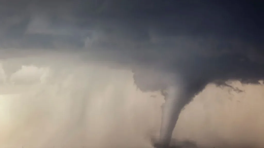
FOX Weather’s Storm Tracker, Brandon Copic, reported a likely tornado near Stanford, Illinois, as tornado-warned storms moved across the state southeast of Peoria.
Earlier, severe thunderstorms developed across Nebraska and Iowa, bringing snow, blizzard conditions, and thundersnow, with power outages rising across those areas.
As the system moves east, the threat of severe weather will increase across the Midwest, Ohio Valley, and Deep South, including Mississippi and Alabama.
The FOX Forecast Center expects thunderstorms to intensify by Wednesday afternoon, with supercells possibly forming a fast-moving line across Illinois and Indiana.
NOAA’s Storm Prediction Center has issued a severe weather risk for nearly 53 million people, with damaging winds, large hail, and tornadoes expected. Cities like Peoria, Decatur, and Champaign in Illinois are under a level 3 out of 5 risk for strong tornadoes (EF-2 or higher)..
However, the SPC has placed nearly 2 million people in an area just south of Chicago, from central Illinois to far western Indiana, in a level 3 out of 5 risk on its severe thunderstorm risk scale.
This level 3 risk zone, which includes cities such as Peoria, Decatur and Champaign in Illinois, faces the threat of strong tornadoes (EF-2 or higher).